


Hurricane Erin Strengthens Offshore, Drenches Caribbean
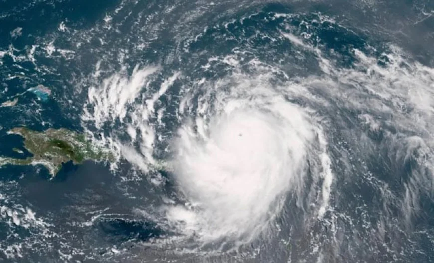
Hurricane Erin rapidly strengthened offshore to a "catastrophic" Category 5 storm on Saturday, as rain lashed Caribbean islands and weather officials warned of possible flash floods and landslides. The first hurricane of what is expected to be a particularly intense Atlantic season, Erin is expected to drench Caribbean islands with rain and strong winds but not make landfall. "The center of Erin is expected to move just north of the Virgin Islands and Puerto Rico through Sunday, and pass to the east of the Turks and Caicos Islands and the southeastern Bahamas Sunday night and Monday," the US National Hurricane Center (NHC) said in its latest report.
The storm's maximum sustained winds were blowing at 150 miles (241 kilometers) per hour, the report said. Hurricane Erin was located about 160 miles (257 kilometers) northwest of Anguilla in the northern Leeward Islands, an area that includes the US and British Virgin Islands. Tropical storm watches were in effect for St Martin, St Barthelemy, Sint Maarten and the Turks and Caicos Islands. "Erin is now a catastrophic Category 5 hurricane," the NHC announced earlier Saturday, denoting highly dangerous storms with sustained wind speeds above 157 mph.
The storm reached the highest level on the Saffir-Simpson scale just over 24 hours after becoming a Category 1 hurricane, a rapid intensification that scientists say has become more common due to global warming. The storm could drench the islands with as much as six inches (15 centimeters) of rain in isolated areas, the NHC said. "Continued rapid strengthening is expected today, followed by fluctuations in intensity through the weekend," the agency said in an earlier report.
It also warned of "locally considerable flash and urban flooding, along with landslides or mudslides." Swells generated by Erin will affect portions of the northern Leeward Islands, Virgin Islands, Puerto Rico, Hispaniola, and the Turks and Caicos Islands through the weekend. Those swells will spread to the Bahamas, Bermuda and the US East Coast early next week, creating "life-threatening surf and rip currents," the NHC said.
The hurricane is expected to turn northwest on Saturday night, then turn northward early next week. It is expected to weaken from Monday. While meteorologists have expressed confidence that Erin will remain well off the US coastline, they said the storm could still cause dangerous waves and erosion in places such as North Carolina. The Atlantic hurricane season, which runs from June until late November, is expected to be more intense than normal, US meteorologists predict.
Several powerful storms wreaked havoc in the region last year, including Hurricane Helene, which killed more than 200 people in the southeastern United States. The National Oceanic and Atmospheric Administration -- which operates the NHC -- has been subject to budget cuts and layoffs as part of US President Donald Trump's plans to greatly reduce the size of the federal bureaucracy, leading to fears of lapses in storm forecasting. Human-driven climate change -- namely, rising sea temperatures caused by the burning of fossil fuels -- has increased both the possibility of the development of more intense storms and their more rapid intensification, scientists say.